
Size

Map of Israel in the Time of Jesus
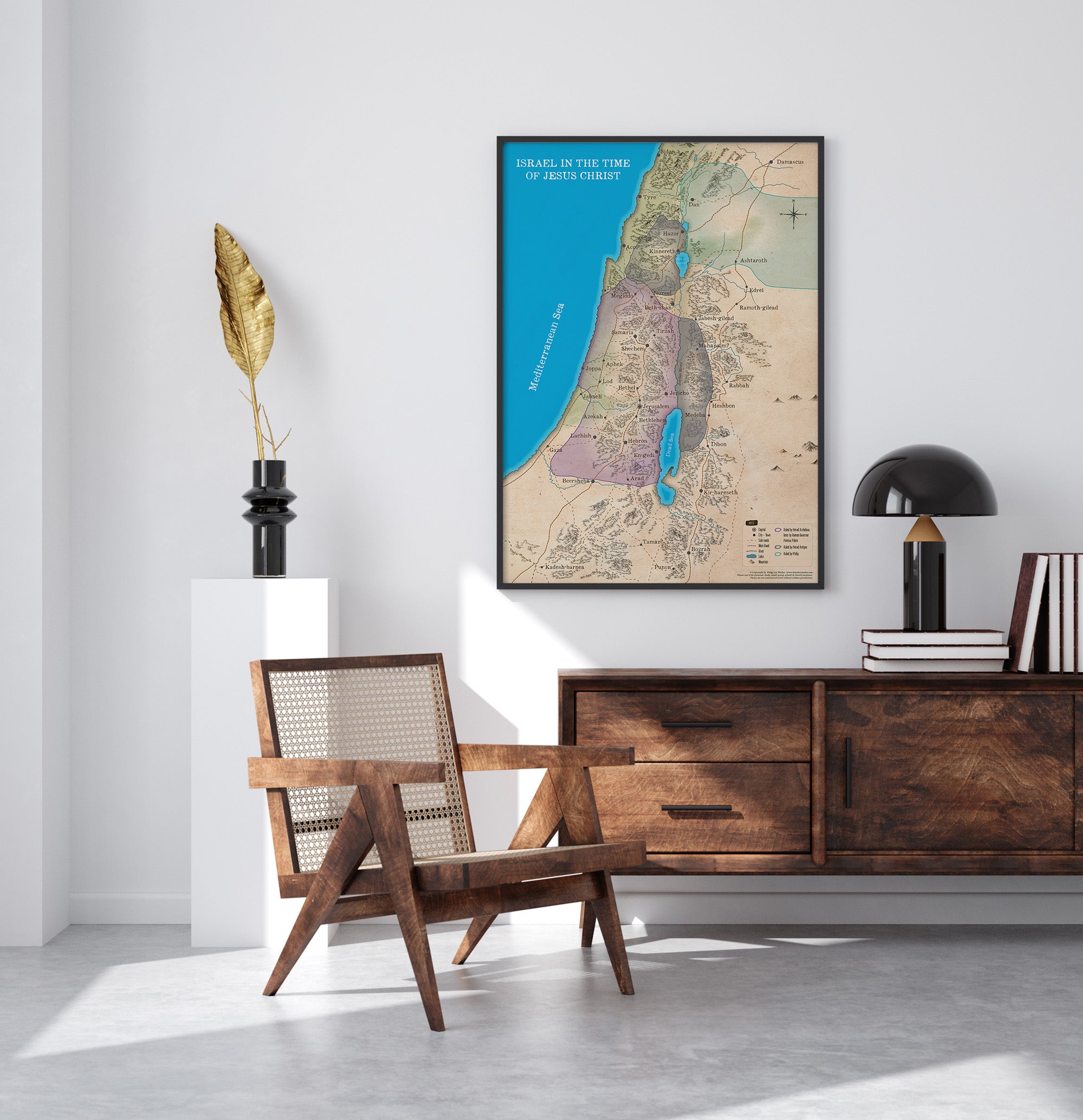
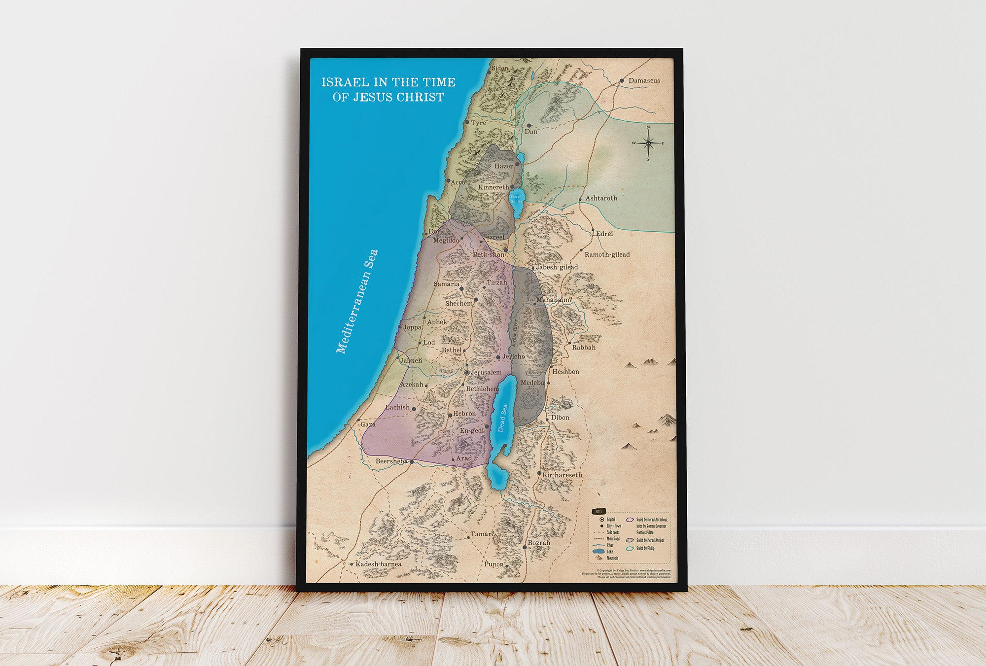
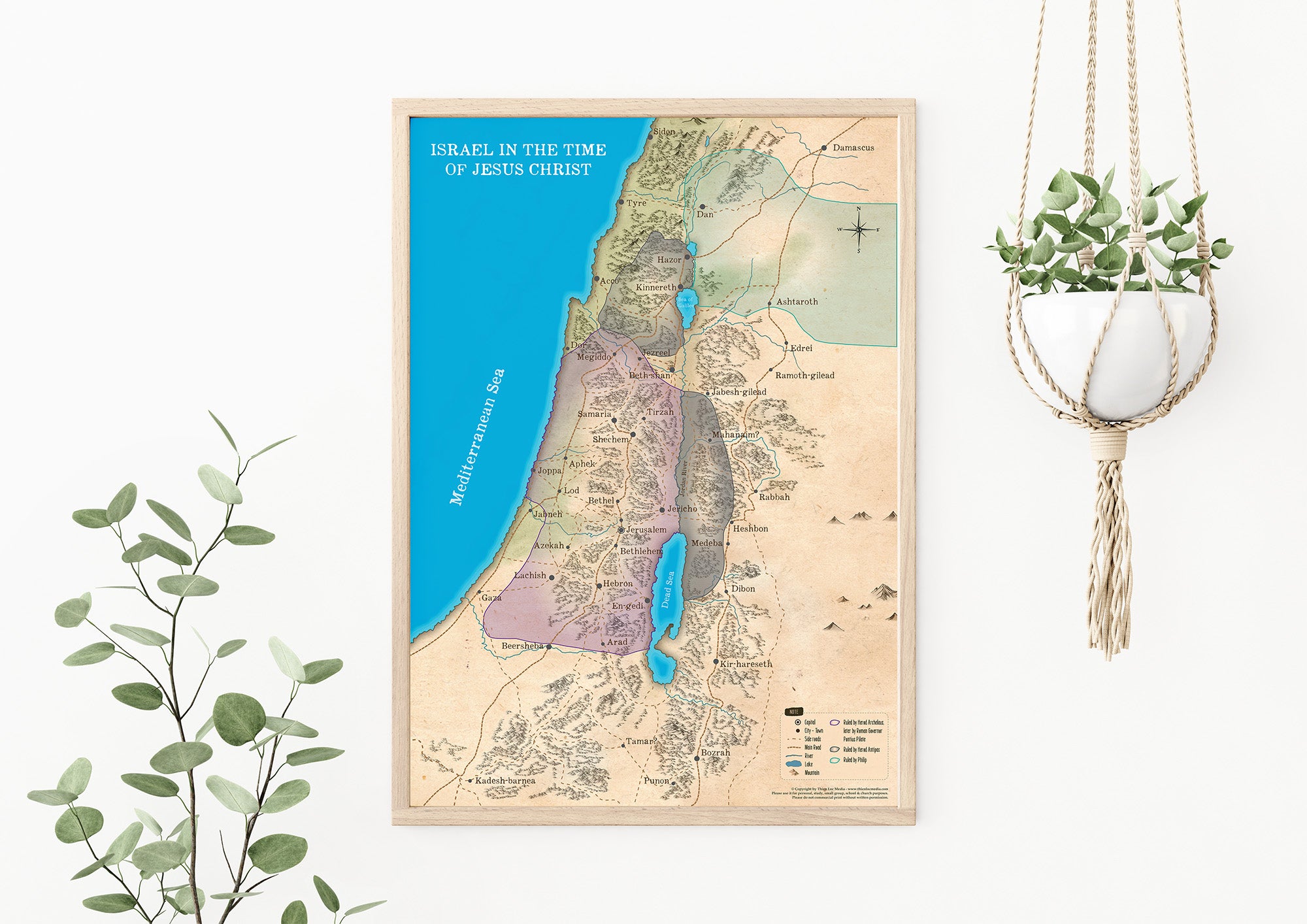
Explore Israel during the time of Jesus Christ with this high-quality Bible map, printed on canvas or matte paper. This detailed map illustrates key locations such as Jerusalem, Bethlehem, and Nazareth, offering insight into the political and cultural landscape under Roman rule during King Herod’s reign.
Perfect for Bible study, Christian education, homeschooling, and church teaching, this map provides a clear visual reference for one of the most significant events in biblical history.
Highlights
Made by Thiên Lộc Media
Materials: Canvas
Canvas Print – No Frame
✔️ High-DPI printing with vibrant, long-lasting colors.
✔️ Premium canvas material for a classic, elegant look.
✔️ Unframed print – Ideal for display or framing.
Size
✔️ A0: 841 x 1189 mm (33.1 x 46.8")
✔️ A1: 594 x 841 mm (23.4 x 33.1")